- Reaction score
- 1,093
- Points
- 1,060
what helo would be operated from the AOPS? Cyclone and Cormorant seem Iike too big and overkill. I see theres a Polar Icebreaker helo project too that seems like it wants something more than the Griffon

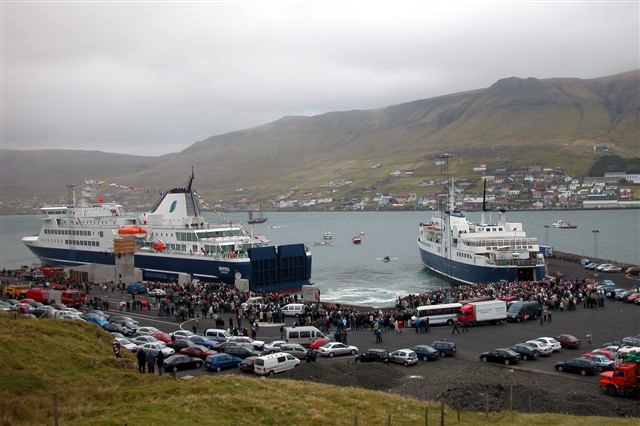
Are you referring to the Arctic refueling depot?What the over/under of Nunavut being fully operational by Aug-September?
Anyone want to start a pool on this?
SeaHawkwhat helo would be operated from the AOPS?
")
Cyclone and Cormorant seem Iike too big and overkill. I see theres a Polar Icebreaker helo project too that seems like it wants something more than the Griffon
I say we get a few of thesewhat helo would be operated from the AOPS? Cyclone and Cormorant seem Iike too big and overkill. I see theres a Polar Icebreaker helo project too that seems like it wants something more than the Griffon

what helo would be operated from the AOPS? Cyclone and Cormorant seem Iike too big and overkill. I see theres a Polar Icebreaker helo project too that seems like it wants something more than the Griffon
Would you shuttle helicopters from the south or pursue the recruiting-friendly concept of stationing them permanently in the Arctic?If the AOPS is operating in the Arctic and as a national Offshore Patrol Vessel then it can be supported by shore based helicopters, particularly long ranged helicopters like the Cormorant. The Cormorant has bounced off of offshore oil rigs to conduct long range SAR missions.
The AOPS could operate in the same manner, acting as a Forward Refuelling Post.
It could also bounce Chinooks and Cyclones.
They do not need to support Cyclones unless they are deployed in foreign waters or the high seas.
Nanisivik?What the over/under of Nunavut being fully operational by Aug-September?
Anyone want to start a pool on this?
Both. I suspect one could find some Res Tac Hel slots from Helo pilots already up there.Would you shuttle helicopters from the south or pursue the recruiting-friendly concept of stationing them permanently in the Arctic?
Paging @Good2GolfCan an AOPS handle a Chinook?
AOPs was spec’s to land-on a Hook. JSS as well. Not sure about anything other than a short stop, re: tie down and replenishment. I didn’t recall those reqrs off hand. Canuck Hooks have done other big grey things (aka USN), but don’t have a comparison of capabilities between the already proven CH-147F/USN interactions and the RCN ships.Both. I suspect one could find some Res Tac Hel slots from Helo pilots already up there.
Paging @Good2Golf
I would assume it could do a rear wheel ‘hover’ but I don’t think it could land engine off and be stored on it. But the SME will know.

Would you shuttle helicopters from the south or pursue the recruiting-friendly concept of stationing them permanently in the Arctic?
Can an AOPS handle a Chinook?
I’d argue it’s the will to (a) build and (b) maintain. The railway to Churchill is a classic example, although many other examples are found all around this country.The problem with a road up there isn't distance, it's terrain. The same thing that has seen the rail line up there in and out of service over the years.
The city of Ottawa is instructive in their Light Rail system; fully contracted out, the stations are already is disrepair, the trains although getting better have had many breakdowns, some shutting the system for weeks.I’d argue it’s the will to (a) build and (b) maintain. The railway to Churchill is a classic example, although many other examples are found all around this country.
Other countries push highways and railroads through very inhospitable terrain and climates for far less important objectives than we might have. We don’t do the same because of cost to build and cost to maintain at anything other than a 3rd world standard.
Can you imagine how badly this country will screw up maintaining a high speed rail corridor. We are about to find out, in 200 years when all the assessments and lawsuits conclude.
Prior to, or afterHow many years into the project? 10?
I’d argue it’s the will to (a) build and (b) maintain. The railway to Churchill is a classic example, although many other examples are found all around this country.
Other countries push highways and railroads through very inhospitable terrain and climates for far less important objectives than we might have. We don’t do the same because of cost to build and cost to maintain at anything other than a 3rd world standard.
Can you imagine how badly this country will screw up maintaining a high speed rail corridor. We are about to find out, in 200 years when all the assessments and lawsuits conclude.
The 18 islands making out the Faroe Islands has 53,000 inhabitants and now 20 tunnels, of which three are long tunnels under the sea. Two more are already under construction, and another 14 are on the drawing board or wish list.
The biggest of the future tunnel projects will be the tunnel from the southmost island of the Faroe Islands, Suðuroy, to the island of Sandoy. The tunnel is expected to cost around 3.4 billion DKK ( 450 million Euro) and will be around 22-24 kilometres (13-15 miles) long, making it the longest car traffic subsea tunnel in the world.
 visitfaroeislands.com
A bit of apples and oranges. The Strait of Belle Isle may only be a comparative handful of kilometers, but to get to it from the ROC is a couple of thousand, either via the Trans-Labrador Highway or a virgin route along the north shore of the St. Lawrence. Nasty terrain and climate either way. It then lands at the most remote end of the island. I would suspect that, in economic terms, transportation companies would still find the ferries cheaper and faster.Meanwhile -
Gulf Islands in BC - 26,000 population
Vancouver Island - 864,000 population
Distance from Westham Island to Galiano Island - 28 km
Distance from Galiano to Salt Spring Island - 4 km
Distance from Salt Spring Island to Vancouver Island - 1 km.
....
Distance from Labrador to Newfoundland - 18 km
A bit of apples and oranges. The Strait of Belle Isle may only be a comparative handful of kilometers, but to get to it from the ROC is a couple of thousand, either via the Trans-Labrador Highway or a virgin route along the north shore of the St. Lawrence. Nasty terrain and climate either way. It then lands at the most remote end of the island. I would suspect that, in economic terms, transportation companies would still find the ferries cheaper and faster.
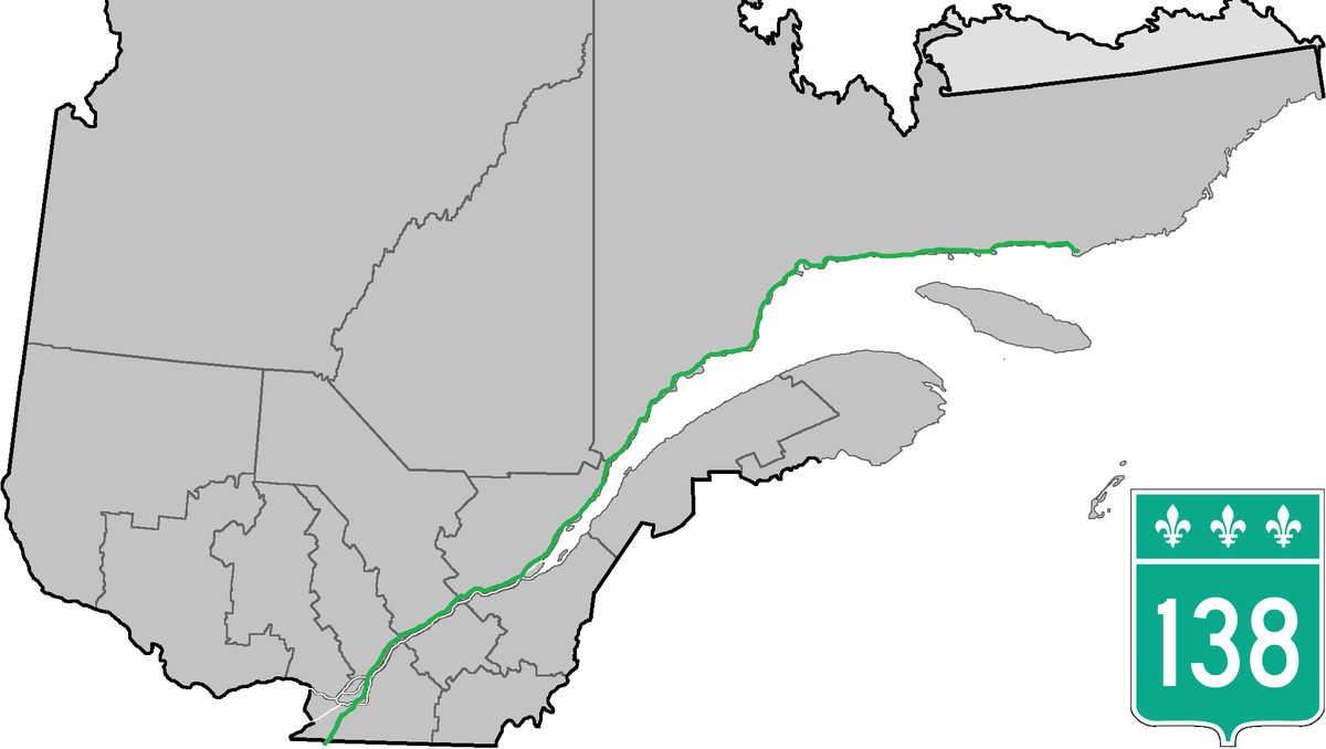


Until the mid-1990s, the (138) highway's eastern terminus was Havre-Saint-Pierre, but in 1996 the extension to Natashquan was completed. A 40 km gravel section between Natashquan and Kegaska opened on September 26, 2013, with the inauguration of a bridge across the Natashquan River.[4]' [5]
A third segment of Route 138 extends from Old Fort to the Newfoundland and Labrador border (connecting with Newfoundland and Labrador Provincial Route 510), near Blanc-Sablon on the eastern end of the Côte-Nord.[6]
A gap remains between Kegaska and Old Fort, through isolated communities accessible only by coastal ferry. On August 25, 2006, the Quebec government announced a 10-year project to connect the two segments by building 425 km of highway along the Lower North Shore. In 2011, the Quebec government announced an additional $122 million investment for the project over five years as part of the Plan Nord.[7] However, by 2013 difficulties ensued between the Quebec Ministry of Transport and the Pakatan Corporation, who was previously responsible for managing the funding for this project, leading to the termination of agreement between the two. By this time only 12 km of this road had been built, plus some additional engineering work and deforestation.[8] The construction of two segments of the highway (Kegaska–La Romaine and Tête-à-la-Baleine–La Tabatière) was set to begin in 2019. A total of $232 million will be contributed to this project.[9]

 cib-bic.ca
 nationalpost.com
When Minister Dominic LeBlanc took over the infrastructure portfolio in 2021, he was instructed to keep working on the project.
“Support major nation-building projects that will benefit people across various regions, connect our country and improve quality of life, including the Newfoundland-Labrador fixed transportation link,” his mandate letter from the prime minister said.
The proposed fixed link has been an idea floated for decades, going back to the province’s first premier, Joey Smallwood.
Hatch Engineering was commissioned in 2018 to revisit the idea, updating work done in a 2004 study, and estimated that a rail tunnel under the Strait of Belle Isle, running from Yankee Point, Newfoundland to Point Amour, Labrador would cost $1.675 billion. The 18-kilometre rail tunnel was the least expensive option available, it said, and it was proposed that it carry cars and trucks across on special train cars, in addition to passengers.
With enough will and money you can probably build anything to anywhere. When rock is involved, it is costly but likely more stable. One problem with northern Ontario and, I suspect, northern Manitoba, is pervasive muskeg, which is basically a mat of peat floating on water. I have stood on what I though was solid ground and jumped up and down and could make a tree sway. Early highway and rail construction basically laid down cords and cords of wood ('corduroy') until it stopped sinking, which sometimes took weeks. Depending on the local geology, you might be able to use the sand/gravel outcroppings, provided they go in the direction you want to go. Even today, the ONR's trains to Moosonee constantly sway from side-to-side, which limits both weight and speed. There was talk at one point of using GO-Transit bi-level passenger cats for the Polar Bear Express but found that anybody riding in the upper deck would probably become ill.


 www.hotcars.com
